


Voting District 0420, Parker County, Texas
About
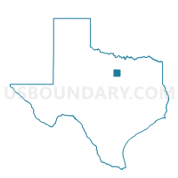
Outline

Summary
| Unique Area Identifier | 676379 |
| Name | Voting District 0420 |
| County | Parker County |
| State | Texas |
| Area (square miles) | 24.97 |
| Land Area (square miles) | 24.97 |
| Water Area (square miles) | 0.00 |
| % of Land Area | 100.00 |
| % of Water Area | 0.00 |
| Latitude of the Internal Point | 32.60674440 |
| Longtitude of the Internal Point | -97.57881990 |
Maps


Graphs
Select a template below for downloading or customizing gragh for Voting District 0420, Parker County, Texas


Neighbors
Neighoring Voting District (by Name) Neighboring Voting District on the Map
- Voting District 0001, Johnson County, TX
- Voting District 0015, Hood County, TX
- Voting District 0345, Parker County, TX
- Voting District 0435, Parker County, TX
- Voting District 0440, Parker County, TX
- Voting District 1111, Tarrant County, TX
- Voting District 1447, Tarrant County, TX
Top 10 Neighboring County Subdivision (by Population) Neighboring County Subdivision on the Map
- Fort Worth CCD, Tarrant County, TX (791,745)
- Granbury East CCD, Hood County, TX (41,920)
- Weatherford Southeast CCD, Parker County, TX (27,636)
- Godley CCD, Johnson County, TX (4,035)
Top 10 Neighboring Place (by Population) Neighboring Place on the Map
Top 10 Neighboring Unified School District (by Population) Neighboring Unified School District on the Map
- Fort Worth Independent School District, TX (466,910)
- Granbury Independent School District, TX (47,990)
- Aledo Independent School District, TX (20,504)
- Godley Independent School District, TX (7,057)
Top 10 Neighboring State Legislative District Lower Chamber (by Population) Neighboring State Legislative District Lower Chamber on the Map
- State House District 61, TX (176,054)
- State House District 58, TX (169,146)
- State House District 97, TX (168,045)
- State House District 60, TX (148,990)
Top 10 Neighboring State Legislative District Upper Chamber (by Population) Neighboring State Legislative District Upper Chamber on the Map
- State Senate District 10, TX (834,265)
- State Senate District 30, TX (823,594)
- State Senate District 22, TX (789,412)
Top 10 Neighboring 111th Congressional District (by Population) Neighboring 111th Congressional District on the Map
- Congressional District 12, TX (831,100)
- Congressional District 6, TX (809,095)
- Congressional District 17, TX (760,042)
Top 10 Neighboring Census Tract (by Population) Neighboring Census Tract on the Map
- Census Tract 1407.04, Parker County, TX (7,495)
- Census Tract 1602.09, Hood County, TX (7,206)
- Census Tract 1407.06, Parker County, TX (6,557)
- Census Tract 1301, Johnson County, TX (4,035)
- Census Tract 1110.10, Tarrant County, TX (2,841)
- Census Tract 1108.08, Tarrant County, TX (1,900)